
Train & Bus
Travelling by public transport
Public transport
Arrival by train: Station: Mallnitz
It is a beautiful, longer hike directly from the railway station through the Dösen valley (approx. 4 hours)
Arrival by bus / bus stop: Mallnitz, with the valley bus (HPV Mölltal) to the Dösen car park;
The valley bus of the municipality of Mallnitz runs free of charge from Mallnitz P&R station on weekends and public holidays during the holiday season
Taxi Mallnitz, Dösen car park (on request, order 0664/1278579).
Coordinates
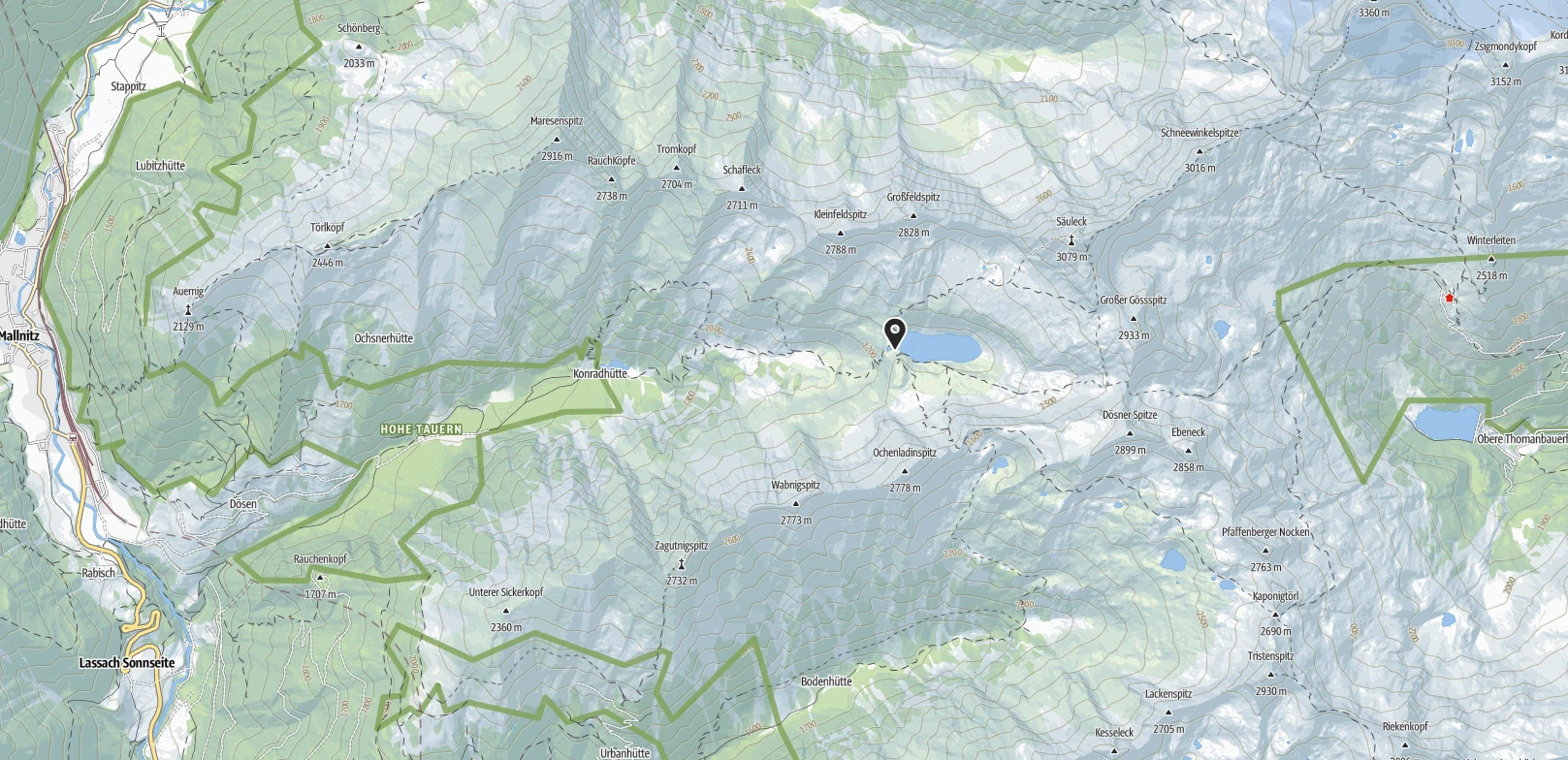
Location of the hut
DD: 46.989098, 13.267216
GMS: 46°59'20.8 "N 13°16'2 "E
UTM: 33T 368239 5205410
w3w : ///exclamation.oasis.upperarm
Huts in the neighbourhood
Arrival
By car
Approach:
Mallnitz, Dösen car park (charges apply)
Hike: Allow around 3 hours for the route, distance: 6.37 km ↑+853 m ↓-23 m
This hike in high alpine terrain requires appropriate surefootedness and a little fitness.
Access to the hut
Tours in the area
Contact
Tenants:
Katerina & Michele Gallonetto
9822 Mallnitz, Dösen 6
Hut telephone
during the season: 04784 / 200 71
Email: info@arthurvonschmidhaus.at
Opening hours:
Open until 17 September!
Due to preparations for winter and limited food supplies, our services will be somewhat restricted during our final week.
We appreciate your understanding and look forward to seeing you!
Weather & tour planning
The weather in the mountains can change quickly and has a decisive influence on your safety and mountain experience. Careful weather planning is therefore essential for every mountain tour!
Weather planning: from the big to the small
For a reliable weather assessment, we recommend first looking at the large-scale weather situation and then moving on to local forecasts. We can recommend the following weather services:
Alpine Club Weather
- Comprehensible text descriptions of the weather data by Geosphere Austria
- Comprehensive presentation of the general weather situation in the Eastern and Western Alps with important parameters (temperature, zero degree limit, wind, fresh snow)
- Detailed descriptions for individual Alpine regions and mountain groups
- Ideal for an initial overview and basic tour planning
- Updated once a day.
https://www.alpenverein.at/portal/wetter/
Load "external components" for display if necessary.
Meteoblue
- Precise weather information with symbols and probabilities
- Hourly weather forecasts available
- Simple query of point weather via GPS coordinates
- Rain radar for tracking approaching weather fronts
- Particularly useful for short-term and detailed planning
- Frequent data updates